Hallstatt hiking
A walk around the lake, a gentle climb over the Hallstatt ridges or hiking in the high mountains? Are you asking if you can go hiking in Hallstatt? Wherever you go from Hallstatt, you will love it.
Can you hike in Hallstatt?
In the Hallstatt Dachstein Salzkammergut, a UNESCO World Heritage Site, there are beautiful places everywhere you look. We recommend discovering these places by foot. Thanks to its location, Hallstatt is a strategic place for any kind of tourism. Both demanding and undemanding tourists will be satisfied here. A unique spectacle awaits you!
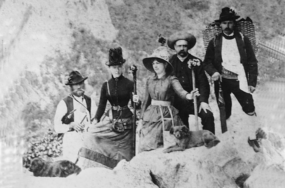
The Austrian Empress Elisabeth, better known as “Sisi”, oved hiking, especially in the area around Hallstatt. She required her court ladies to be fit to keep up with her on hikes in the Alps. In some cases, the ladies were carried out by porters. In such cases it was a terrible experience for everyone else, but the ladies were happy
There are many different routes to choose from around Hallstatt. We have tried to select the most interesting ones for you according to their difficulty. These are trails that have a lot to offer and often thanks to them you will discover the most famous of the Hallstatt area.
Easier hiking to start with
If you are in Hallstatt with your family or don’t feel like hiking in the high mountains, then these routes are for you. The routes are pleasant and can be handled by anyone who has ever been for a longer walk.
Panorama trail above Hallstatt
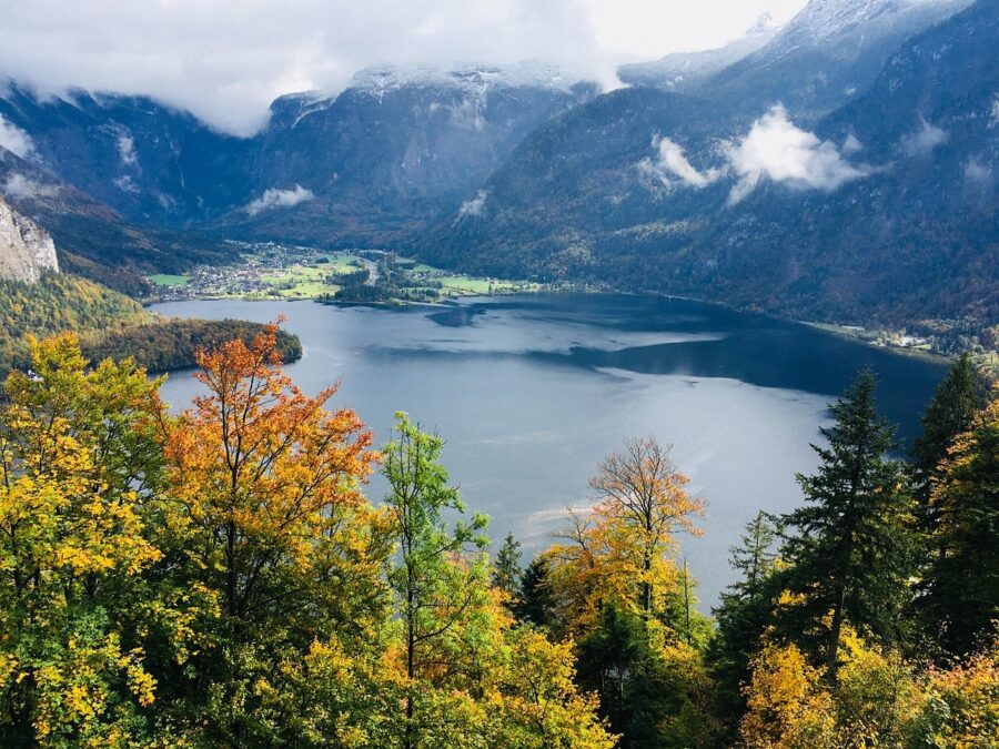
If you are looking for an easy route from Hallstatt for your family, we have a great family-friendly hike for you. The hike is less than 6 km long, but you will discover all the beauties of Hallstatt.
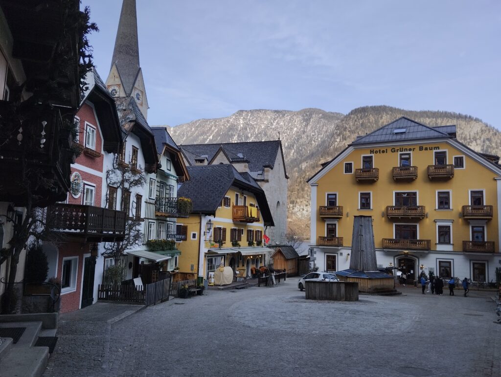
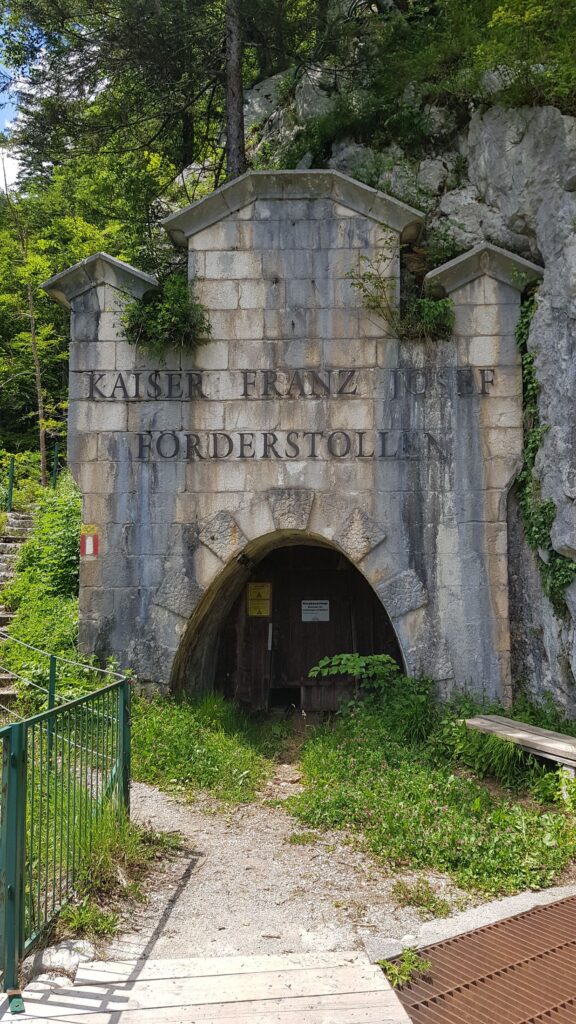
We chose Hallstatt Square as the starting point of the route. From there, take the street past the Heritage Hotel, you will pass a tourist signpost, then turn right along the main road and then turn left onto Kirchensteig. Follow the Gaiswandweg to the viewpoint and continue uphill. There are a few sharp turns after which you turn left onto Kaiser Franz Josef Förderstollen
And from here you head towards the Rudolfsturm. In addition to the spectacular views, there is also a home-style restaurant located right in the tower. Finally, follow the signs for Hallstatt to Müllerstiege.
- Beautiful view from the terrace. Pleasant and fast service. Acceptable prices.
- The only restaurant at the upper station of the cable car at the saltmine. The food is tasty, the service is pleasant and they try very hard to understand each other even in English. I would have expected more typically Austrian dishes (veal steak and potato salad, lamb…), but you still have your choice.
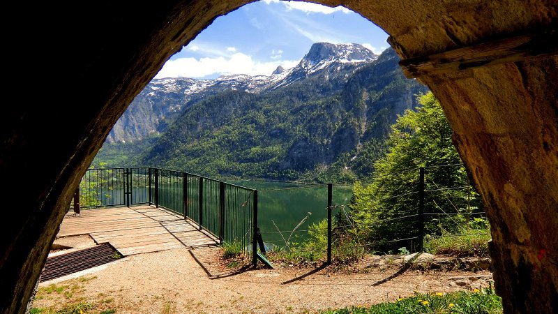
If you are visiting the Rudolfsturm, then we also recommend visiting the Skywalk, which is about 2-minute walk from the restaurant.
Then follow the signs to the right to Salzwelten and continue straight ahead to the Chapel of the Stations of the Cross and then head towards Hallstatt Lake. Finally, follow the lake back to the starting point.
Echerntal, Waldbachstrub and glacier garden
If you want to look around the Hallstatt, we commend an easy walk to the gorgeous waterfalls. If you only have Hallstatt as a starting point and have arrived by car, we recommend that you look in advance at the best places to park.
A pleasant day trip full of refreshing waterfalls and rapids awaits you. Of course, there are views. And all this without a lot of tourists!
To the Waldbachstrub waterfalls in Hallstatt, I recommend a three-hour hike through the romantic Echerntal. The Echern Valley is not for tourists in a hurry. Take a deep breath and enjoy the nature around you.
From the center of Hallstatt, you can reach the waterfall in about 1.5 hours. I recommend exploring the route more, you can go to the glacier garden, about 30 minutes away from the waterfall.
If you don’t have enough time or just want to take a pleasant walk instead of a day trip, you can just do a short circuit. You can walk to the waterfall on one side of the river and back on the other side.
See map
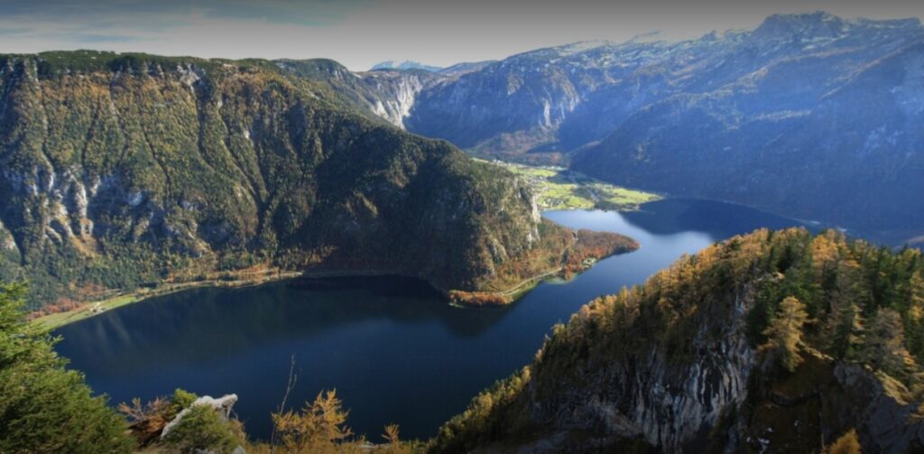
Can you hike around Hallstatt lake?
Yes, you can get around the lake and it is one of the most popular hiking trails. It’s very popular due to its moderate difficulty. It is a trail almost 23 km long, it will take you about 6.5 hours.
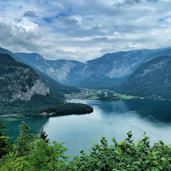
On the eastern side of the lake, the trail leads through the Ostuferwanderweg. On the west side of Lake Hallstatt you follow the Soleleitungsweg. This is the original 40 km long route. The route around Hallstatt is thus only part of this trail.
Trail for advanced hiking fans
Since it is a high mountain hiking, it is necessary to follow the rules and be well prepared for the hike. We recommend these routes for experienced hikers.
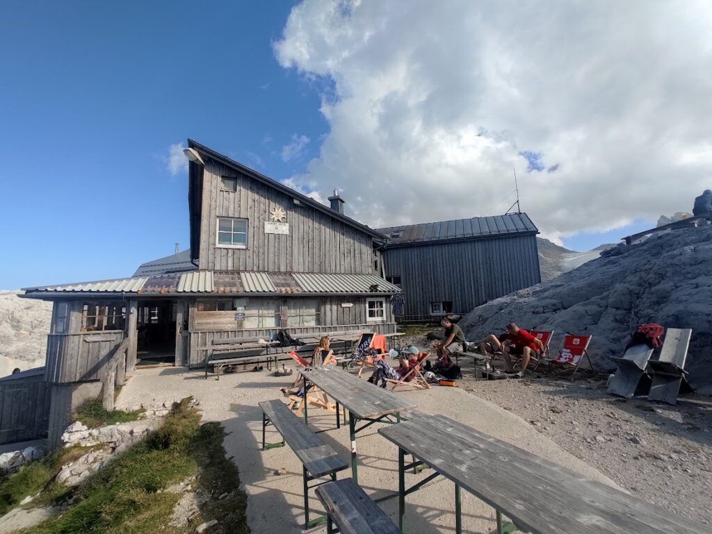
Hiking to Simonyhütte from Hallstatt
First of all, it must be said that it is necessary to be physically prepared for this hike and to have good hiking equipment. This hike can be done in one day, but we recommend staying overnight at the Simony Hut – the most beautiful sunsets and sunrises are here!
Total train time can be up to 10 hours. It will take you through the Echerntal valley past the famous glacier garden to the Wiesberghaus and the Simonyhütte. The hike ends in Obertaun and it is possible to get back to Hallstatt by public transport. Anyway, the route can also be taken in the opposite direction.
The hike first leads along a path that then narrows through the forest and begins to climb until you come to the hut “Tiergartenhütte”. You don’t have to take sides from the lack of clarity, the trail is very well way marked.
On the route you will also pass the so-called “Simony Hut” which is an emergency accommodation that served as a shelter for the great Dachstein researcher Professor Simony. From this hut you are not far from your destination, which you will know, among other things, by how beautiful the views will be in front of you.
Simonyhütte awaits you at the top, where you can spend the night or have a good snack.
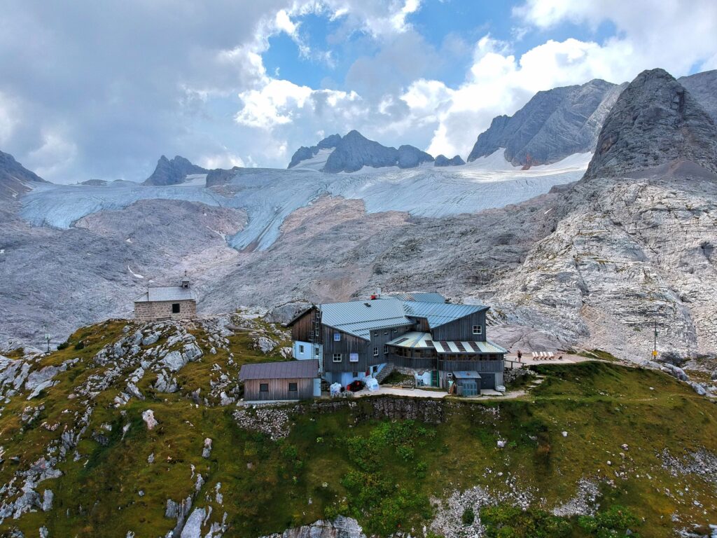
Alpine Club Austria – Simonyhütte
- After a beautiful hike, excellent goulash soup and beer.
- Beautiful, clean cabin on the Dachstein. I was pleased with the vegetarian dishes
- Great mountain hut! Great food supply from extremely friendly employees and they bake it themselves. The water supply is somewhat limited due to the self-sufficiency of the hut. But didn’t bother us.
See map
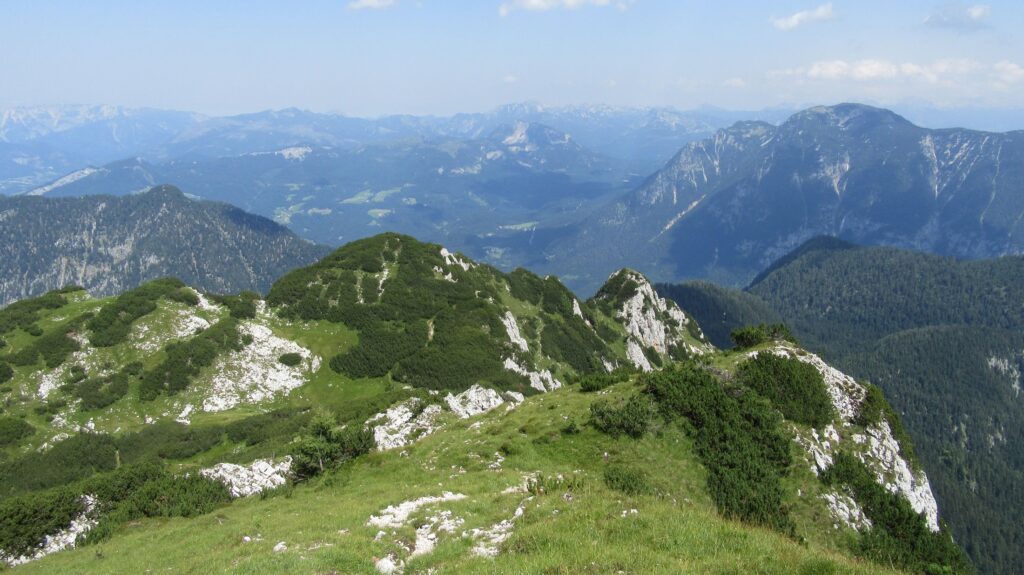
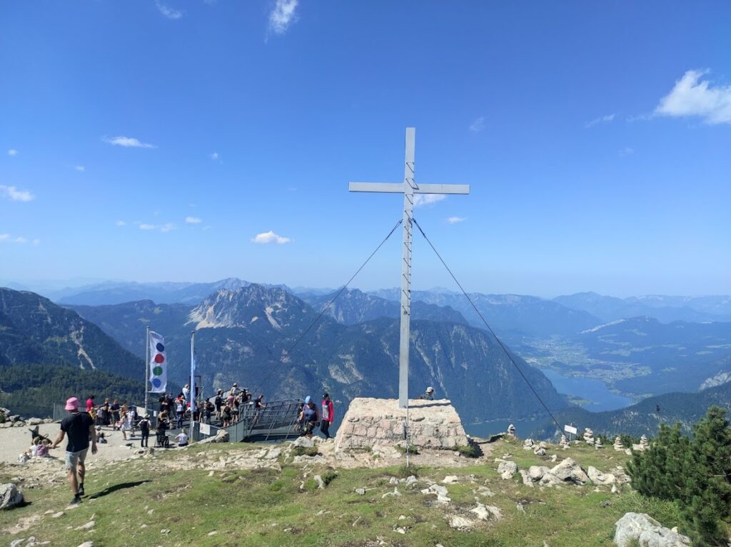
Hiking trail from Hallstatt to the Plassen
This trail is also one of the more demanding ones and the hiker should be prepared for it. The hike is less than 7 km long and it is necessary to count on at least 5 hours of walking. Right at the beginning you will have a rather steep climb up to Salzberg. As this is also the entrance to the salt mines, you will also pass the miners’ huts.
Beyond these huts you will find a forest path that turns sharply upwards towards the Hohen Wasserstollen. It is at this point that the path to the top of Plassen becomes difficult. As you climb up the small saddle, the route passes through sections of forest.
You’ll find here pine trees and scrubland, followed by a rather difficult section. However, this is made easier and secured by metal railings. After crossing this part, endlessly beautiful views await you.
- Trail to Plassen from Salzberg was rocky 2km before peak, but the view was really spectacular. (on Hallstatter see, Hoher Dachstein, etc.) I really recommend Plassen as a trip for people with little physique not for rookies, because some parts are really tough especially the rocky one.
- Beautiful quiet panoramic mountain
Hallstatt hiking summary
Around Hallstatt you will find a really large number of trails. Thanks to this variety, there is a choice for everyone. You will love just any any trail around Hallstatt. Each one has carved out its own piece of the beautiful countryside.
Many of these routes in the area you can combine according to your preference. For planning, we recommend always using a map that you will have at hand during your trip. If you are no longer a fan of the classic paper map, you can download the komoot app, for example. Here you will have the maps safely at hand.

🔗 More Hallstatt Adventures You’ll Love
If you enjoyed this guide to hiking in Hallstatt, here are more places I’ve explored and written about — ideal for expanding your trip:
- Skywalk of Hallstatt – Lake and Village from Above – For the best panoramic views right above the village
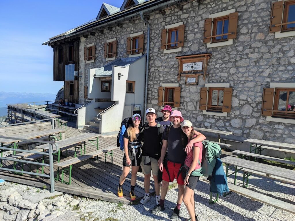
- Adamekhütte – A Mountain Hut for Thrill Seekers and Nature Lovers – A true alpine experience, perfect for glacier lovers
- Plassen – One of my favorite challenging hikes with epic views from the summit
- Waldbachstrub Waterfall – A beautiful stop tucked away in the Echerntal Valley
- Five Fingers – One of the most exciting platforms in the Dachstein mountains
- Simonyhütte – A great base for exploring the high alpine terrain
- Schneidkogel – A Guide to Hiking and Adventure – Quick climb from Hallstatt with views that blew me away
- Gosauseen – An Unforgettable 4-Day Trip – Lakes, peaks, and charming alpine huts — perfect for multi-day hikes
- Hallstatt Museum – For a deeper look into Hallstatt’s 7,000 years of history
- Viewpoint Hallstatt – Another quiet and scenic spot above the village
- Hallstatt Tourist Information Center – Handy for grabbing maps and asking about the current trail conditions
- Some hiking trails open up as early as April — here’s what it’s like in Hallstatt during that time